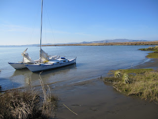
Got all confused with the tides on this trip and started out heading west all the way out to the Carquinez Bridge. Then I realised that the tide was heading out, not in, and that I was going to end up slogging back for miles. So, headed all the way east to Ryer Island to survey landing spots. Total trip distance 32 nautical miles. See nice spot on Roe Island below.
This shot (above) is what is left of the old Roe Island Lighthouse. It was built in the 19th C and was damaged by the Port Chicago explosion on July 17 1944 even though it is 2.7 miles away across the water. Wikipedia says that when it was decommissioned in 1945 it... "consists of the light, with two keepers, with dwellings, outhouses, power house, water supply tanks, wharf, walkways, boat harbor and boatways. Electric current for the light and quarters is generated at the station. Water supply is from rain collected from the building roofs, augmented by supply pumped in from the tenders." The picture below shows the lighthouse in 1924 (WC).


No comments:
Post a Comment